

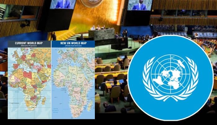
For centuries, millions of students around the world have grown up looking at maps that make Africa appear far smaller than it truly is. While Greenland often looks comparable in size, Africa is in reality more than 14 times larger. Now, the United Nations is taking steps to address what many experts describe as a long-standing cartographic imbalance.
The United Nations General Assembly has adopted a landmark resolution encouraging the wider use of equal-area world maps, including the Equal Earth projection, in an effort to promote a more accurate representation of continents and regions, particularly Africa.
The resolution, titled “Correct the Map: Rebalancing Global Cartographic Representation and Promoting Equitable Representation of the World’s Regions, Particularly Africa,” received overwhelming support, with 164 countries voting in favour. The United States voted against the measure, while six countries abstained.
The initiative, championed largely by African Union member states, seeks to address concerns that the widely used Mercator projection exaggerates the size of regions farther from the equator while shrinking the apparent size of equatorial regions such as Africa and South America.
Presenting the resolution on behalf of African states, Togo’s Foreign Minister, Robert Dussey, described the move as an important step towards ensuring fairness in the way the world is visually represented.
“Correcting the map means recognising that every region of the world deserves to be represented accurately and with dignity,” Dussey said.
Supporters of the measure argue that maps are not merely navigation tools but also shape global perceptions about geography, influence educational materials and contribute to how countries and regions are viewed internationally.
Although the resolution encourages governments, educational institutions, international organisations and technology companies to adopt equal-area projections when geographical size comparisons are important, it does not seek to replace the Mercator projection for navigation purposes, where it remains highly useful.
Togo has announced plans to become the first country to revise its geography textbooks in line with the new approach and intends to engage other African nations and global partners on broader implementation.
Observers say the resolution reflects growing efforts by African countries to challenge historical narratives and promote more balanced global representation in education, governance and international discourse.